A Line in the Sand
by
The Ohio State University NEST team
We recently performed a field experiment at MacDill
Air Force base, as part of the technology evaluation and transition efforts in
the DARPA NEST program. Broadly speaking, our experiment demonstrated the
potential of sensor networks for unattended ground sensing over a large,
distributed region. More specifically, we showcased how to detect, classify,
and track various types of objects (such as persons and cars) using many,
resource-poor smart dust sensor nodes. Smart dust is the popular name
for a wireless sensor network technology developed at the
Some details of our experiment follow; interspersed,
you will find pointers to more detailed technical reports and poster
presentations on (1) the overall approach and design architecture, (2) our
choice of sensors, and (3) particular sensors and middleware services.
Our
field experiment supported the objective of “putting tripwires
anywhere”, including deserts and other areas where physical terrain does
not constrain dismount or vehicle movement. A smart dust sensor
network, empowered with distributed middleware services developed as part of
the NEST program, was used. We
hand-placed 90 pre-configured nodes at known locations, 78 containing magnetometer
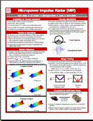
sensors & 12
containing micro-power impulse radar (MIR) sensors, as a basis for locally detecting metallic and nonmetallic
objects moving through the smart dust network (our selection of
sensors took into account several
factors). The nodes self-formed into a network. As objects moved through the
network, the nodes that detected them then cooperated to classify and track
them. Classification of objects with significant
metallic content (such as soldiers and cars)
and objects without significant
metallic content (such as
civilians) was demonstrated at various speeds of motions (ranging from 3mph to
25mph).
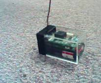
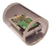
Picture
1. Enclosed mote with a magnetometer sensor Picture
2. Enclosed mote with a MIR sensor
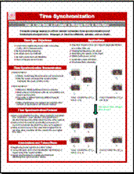
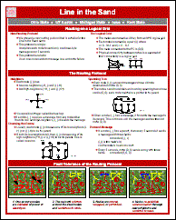
The key enabler in our experiment is NEST “middleware” network software. Examples include software services for routing and time synchronization. The main technical challenge in developing these services was to ensure end-to-end reliable delivery of messages, despite the interference effects in wireless radio communication and failure, movement, or battery exhaustion of the sensor nodes. Each of our services overcame these difficulties by virtue of being self-repairing and self-stabilizing. Their reliability however came at a premium; we observed interesting tradeoffs in reliability versus accuracy and latency.
In terms of performance, our experiment was
remarkably successful. Correct
classification was obtained; there were no false positive or false negative
observations. The quality of “soldier” localization during tracking was in the
1-2m range, whereas for cars it was in the 1-5m range. Tracking was predictably
more smooth and steady for soldiers than it was for cars.
Efforts
to further develop our technology are already underway. Our personal focus will
be on scaling the “line”, say to a 10 km range: we expect to achieve node
density that is far less & a cost/energy budget that scales much better
than that of our experiment. We will achieve this by: (a) using better,
alternative, and additional sensors, (b) incorporating other classification
features, and (c) systematically thinning the line, all while controlling the accuracy.
News
and Media:
Read the OSU
Press Release, dated
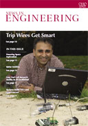 Read the cover
story of in the autumn 2004 issue of News in Engineering magazine published
by the
Read the cover
story of in the autumn 2004 issue of News in Engineering magazine published
by the
Read about some disasters we had en route, not to mention the laptop that got run over by a truck: “Hardware (and Platform) Considerations”. Read more about our NEST project. Additional research papers are forthcoming.
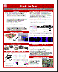
Posters of the demo: (Click
on the poster to view it.)
1. Overview of the demo 2. Magnetometer 3. MIR
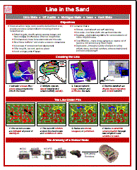
4.
Time
Synchronization 5. Routing
Last Modified: January 7, 2004
Modified by: Vinayak Naik